Markets | Natural Gas Prices | NGI All News Access
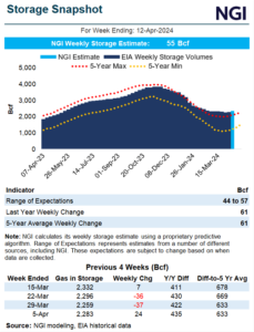
Natural Gas Futures Fly as Midwest Turns Cold, but Weather Models Toying With Traders
Share on:
© 2024 Natural Gas Intelligence. All rights reserved.
ISSN © 1532-1231 | ISSN © 2577-9877 |