Shale Daily | E&P | NGI All News Access
EIA Revamping Shale Maps to Illustrate Geologic History
The U.S. Energy Administration (EIA) wants to give the oil and gas industry a history lesson.
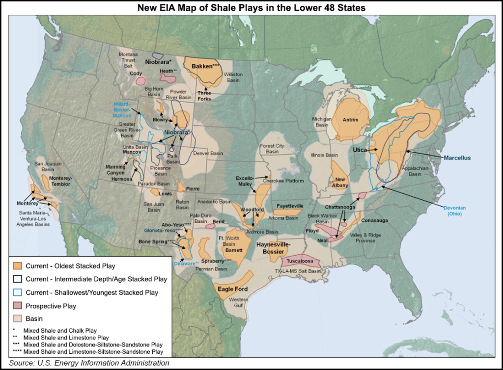
On Friday, the agency said it is in the process of updating its maps of the major tight oil and shale gas plays in the Lower 48 states, through adding illustrations outlining the geologic history and processes of the formations on the new maps.
EIA said that while its current maps focus on the geologic characteristics of the shale and tight oil plays, including rock type and age, “understanding [the] geologic history and processes [will help] exploration and production [E&P] companies reduce the risk of drilling dry, nonproducing wells and better understand hydrocarbon resource potentials.”
The agency later added that “geologic age is an important determinant of hydrocarbon potential, beyond the characteristics of source and reservoir rocks. Identifying fossils, other chemical markers, and correlating rocks across different formations allows earth scientists to determine the age of the rock and to understand the processes that influenced the sediments and organic material over time.”
Last January, EIA updated its geologic maps of the Eagle Ford Shale (see Shale Daily, Jan. 21). The new map provides a better illustration of the formation’s structure, thickness, surface area and gas-to-oil ratio.
© 2024 Natural Gas Intelligence. All rights reserved.
ISSN © 2577-9877 | ISSN © 2158-8023 |