Shale Daily | E&P | NGI All News Access | NGI The Weekly Gas Market Report | Regulatory
Industry Says BLM Moab Master Leasing Plan ‘Shutting Down Development’
The Interior Department’s Bureau of Land Management (BLM) released a proposed plan that it said provides a balance between energy development and conservation for an area of southeastern Utah, but the oil and gas industry slammed it as “redundant.”
Last Wednesday, the BLM released its Moab Master Leasing Plan (MMLP) and Proposed Resource Management Plan Amendments, in tandem with a final environmental impact statement (FEIS). The agency said the MMLP’s planning area covers approximately 785,000 acres of public lands in Grand and San Juan counties, and includes the Arches and Canyonlands National Parks.
“Balance is essential,” BLM Director Neil Kornze said. “In this plan, we make sure that southern Utah’s energy resources can be responsibly accessed while also ensuring that Moab’s recreation economy can continue to flourish.”
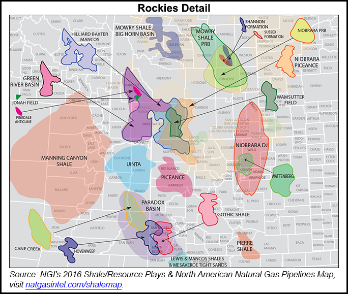
Grand and San Juan counties have seen mostly conventional but also some unconventional oil and gas drilling. The counties overlay the Paradox Basin and the Cane Creek, Gothic and Hovenweep shales.
Under Appendix A of the MMLP, which addresses mineral leasing stipulations, the BLM classified lands within the planning area as either open to leasing and subject to standard lease terms, laws, regulations and orders; open to leasing but subject to major constraints; open to leasing but subject to minor constraints or special stipulations; and closed to leasing. But once classified, the classifications are not set in stone; an authorized BLM officer can issue exceptions, modifications and waivers.
Specific to the oil and gas industry, within many areas multiple wells per pad would be permitted, but well pads would be placed no closer than two miles apart. “Production facilities would be co-located and designed to minimize surface impacts,” Appendix A stipulates. “Pipelines and utilities would be placed within or immediately adjacent to existing roads.”
The proposed plan would also “limit unreclaimed surface disturbance to no more than 15 acres per well pad (including associated facilities, roads, pipelines and utilities) following interim reclamation.” It also states that there should be “extensive interim reclamation of roadway disturbance and reclamation of well pads to minimize long-term surface disturbance.”
The aforementioned stipulations would cover the Courthouse Wash Watershed, the Salt Wash Watershed, Special Recreation Management Areas and lands identified by the BLM as having wilderness characteristics and high visual qualities. The habitat of sagebrush, steppe, bighorn sheep, deer and elk would also be covered.
Kathleen Sgamma, vice president for government and public affairs at the Western Energy Alliance (WEA), was critical of the BLM’s proposed plan.
“BLM continues its efforts to jam in as much regulation as possible on American oil and natural gas producers before the end of the Obama Administration, with this one carrying a cost of $2 billion in lost economic opportunity for local communities,” Sgamma told NGI on Wednesday. “The Moab leasing plan is designed to add yet more layers of environmental analysis into a process that already included four or more, to the point that BLM is unlikely to make decisions to move forward with responsible energy development.
“The MMLP is redundant with recently completed Moab and Monticello Resource Management Plans that included multiple provisions to ensure the land, wildlife, cultural, and other natural resources are protected. It needlessly locks away yet more lands without Congressional consent, closing 57% of the area to development while imposing redundant constraints on the remaining area that will make it extremely difficult to produce energy that all Americans own.”
Sgamma also challenged the legality of the MMLP, saying it runs afoul of the Federal Land Policy and Management Act and the Mineral Leasing Act. “It’s simply about shutting down development,” she said.
Once a notice of availability is published in the Federal Register on Friday, a 30-day public protest period and a 60-day governor’s consistency review period will begin over the proposed plan.
According to NGI’s North American Shale & Resource Plays Factbook for 2016, the Paradox Basin straddles southeastern Utah and southwestern Colorado. It has traditionally been known more for conventional oil and gas production. The basin’s Aneth Field, discovered in 1956, is operated today by Resolute Energy Corp. (see Shale Daily, Nov. 24, 2015).
USGS scientists had previously determined that the Gothic Shale was one of the several shales that appeared to “have the most potential due to both organic content and thickness,” (see Shale Daily, Aug. 26, 2011).
In 2008, Bill Barrett Corp. reported initial well results at a prospect in the Gothic Shale (see Daily GPI, Nov. 6, 2008). At the time, the company had built a 397,000-gross acre position in the Paradox Basin, which included about 208,000 net undeveloped acres. Bill Barrett’s first gas sales from the basin were reported in early 2009 (see Daily GPI, Jan. 26, 2009).
According to Baker Hughes Inc. data, San Juan County hasn’t had an active drilling rig since mid-February 2014, while Grand County has been without drilling activity since mid-February 2015.
© 2024 Natural Gas Intelligence. All rights reserved.
ISSN © 2577-9877 | ISSN © 1532-1266 | ISSN © 2158-8023 |