January NatGas Forwards Up 34 Cents as Arctic Air Blankets Country
For the third week in a row, natural gas forwards markets surged by double-digits as much of the U.S. was experiencing bitterly frigid temperatures. And talk of a Polar Vortex in the upcoming week had the market shivering in its snowboots, according to NGI’s Forward Look.
January forward prices rose an average 34 cents between Dec. 2 and 8, while February forwards were up an average 30 cents and the balance of winter (February-March) was up an average of 27 cents, Forward Look data showed.
National gas prices are reflective of the strength in the Nymex. The Nymex January gas futures contract rose 26 cents from Dec. 2 to 8, settling Thursday at $3.695 amid quite a bit of volatility throughout the week.
On Thursday alone, the prompt-month contract began the day sharply lower but then rallied and was a few cents higher prior to the U.S. Energy Information Administration’s weekly gas storage report. Prices continued to rally after the report, then sold off nearly 10 cents and back into the red before surging yet again and settling up 9 cents on the day.
The volatility at the front of the futures curve is nothing new. The last four weeks have seen the January contract gain a whopping 84 cents as weather has become front and center after a slow start to the winter season.
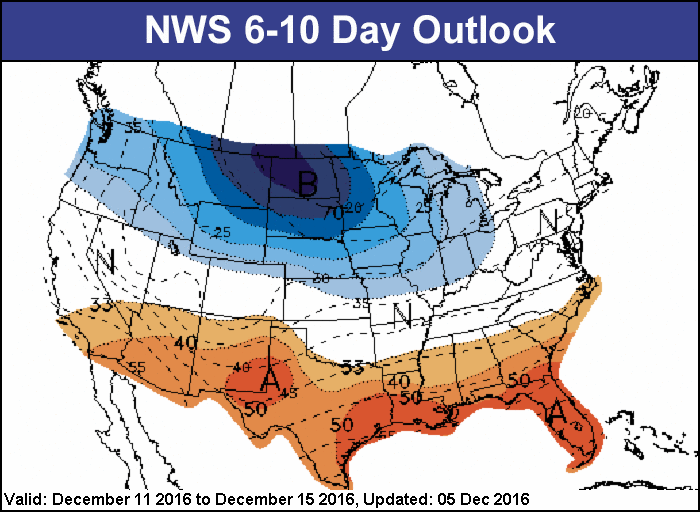
Right now, a strong cold blast continues sweeping into the eastern U.S., with temperatures behind the polar front running 10-30 degrees Fahrenheit below normal as lows drop into the teens to below zero over many regions.
Data and analytics company Genscape showed Lower 48 demand climbed to a winter-to-date high of 93.5 Bcf/d Thursday, with more in store. “Weather forecasts for the next 14 days show more cold to finish out the week, followed by a brief reprieve of normal temps, after which it will be game back on,” the Louisville, KY-based company said.
Arctic Blast Arriving Mid-Week
Genscape’s weather forecast for the Lower 48 had Saturday’s population-weighted HDDs hitting 243 HDDs, about 44 HDDs colder than normal. But a moderate warm-up was expected to push HDDs down to a low by Monday of 170 HDDs, about 35 HDDs warmer than normal. Tuesday’s temperatures were expected to return to seasonal norms, then spike to 289 HDDs by Thursday, 76 HDDs colder than normal.Indeed, forecaster NatGasWeather said a potent Arctic blast arriving in the middle of the week would cap highs over the Midwest/Great Lakes in the teens, including for Chicago, with widespread lows again into the single digits to minus 20 degrees Fahrenheit.
And WeatherBell Analytics Meteorologist Ryan Maue created a media frenzy when he tweeted, “[The] upper-level atmosphere configuration [is] very similar in scale and magnitude as infamous January 2014 #PolarVortex.”
While the weather data was still struggling on exactly how much frigid air should be expected over the northern U.S. in the coming week, any slight shifts in the Arctic front will lead to considerable differences in the amount of natural gas demand expected, so the market should expect some changes, NatGasWeather said.
Forecasters at AccuWeather agreed that the magnitude of cold air that would reach the Atlantic and Gulf Coasts during the week remained unclear. On one hand, the cold air may quickly thrust into the Deep South and Interstate 95 corridor. It is possible, however, that the coldest air may be held back from these areas.
“Should the latter scenario occur, temperatures may be within only a few degrees of the lowest point reached this weekend,” AccuWeather Lead Long-Range Meteorologist Paul Pastelok said. “We will have more information on the extent of the cold in these coastal areas by early next week.”
Highs are likely to be in the 30s along the Interstate 95 corridor of the mid-Atlantic during the latter part of the week. There may be a day or two where temperatures fail to reach the freezing mark from Philadelphia and New York City to Boston.
There is potential for temperatures to trend lower in the South later in the week as well. Should the cold air blast right in, a day or two with highs in the 30s could occur in Atlanta. Should the sky become clear and winds diminish at night, then a freeze could occur along portions of the Gulf Coast, AccuWeather said.
Yet another Arctic air blast may travel from the northern Plains to the southern and eastern states with the central states bearing the brunt of the cold during the third week of December. “For much of the central and eastern states, regardless of the exact temperatures, the coldest overall weather this month will occur during the middle part,” Pastelok said.
The weather system on tap for the third week of December is one NatGasWeather said has trended colder, according to the latest suites of weather data. “It’s worth mentioning, the data still favors some sort of break in the action over the east-central U.S. at days 15-16, but out that far, the data is highly suspect. It’s difficult to say what prices do here, but we still see the pattern as quite cold the next two weeks overall besides brief milder breaks between polar blasts. Again, we must expect prices to remain volatile where rapid 5- to 10-cent price moves should be expected.”
Some Freeze-offs Suspected
In addition to the strong demand that will likely keep the pressure on prices, potential production freeze-offs are also of concern to the market.
Already, Genscape is showing small declines in Midcontinent production, which could be freeze-off related. As of Wednesday evening cycle nominations, the sample production across the Midcon on Dec. 8 was down to 7,307 MMcf/d, a 263 MMcf/d day-over-day drop. The Texas Panhandle led the production declines with a 122 MMcf/d drop. Kansas and Oklahoma also showed declines of 75 and 69 MMcf/d, respectively. Arkansas production was flat, Genscape said.
Last winter, despite being one of the warmest on record, the Midcontinent experienced a freeze-off event in late December 2015 when a strong cold front traversed the Midcontinent states from Dec. 27-29. Midcon production fell roughly 1.65 Bcf/d during the freeze-offs, which lasted between three and four days, Genscape said.
Production fell 20% (about 94 MMcf/d) in Kansas, and in Oklahoma and the Texas Panhandle, supply fell roughly 33% below their prior-30 day averages (roughly, a combined 1.4 Bcf/d). Arkansas saw a 4% drop in production (about 100 MMcf/d), Genscape said.
Not surprisingly, the strong increases across the natural gas forward curves were seen in some of the hardest-hit regions of the country.
At New England’s Algonquin Gas Transmission citygates, the January forward price jumped $1.38 between Dec. 2 and 8 to reach $9.85, according to Forward Look. February was up $1.33 to $9.815, and the balance of winter (February-March) was up $1.19 to $8.03. Even the winter 2018-2019 strip shot up 32 cents to $6.35.
By comparison, the Nymex January futures contract rose 26 cents between Dec. 2 and 8 to reach $3.695, while February climbed 24 cents to $3.68 and the balance of winter edged up 23 cents to $3.66. Farther out the curve, the summer 2017 strip jumped 11 cents to $3.41, while the rest of the curve posted more muted gains of less than a nickel in the face of overwhelming supply and not quite enough demand.
“We feel gas prices are weighed down by bigger wells (we’re now pushing 4 Bcf/1,000 lateral foot EURs, up from 2+), and most management teams comment that they add rigs at $3-3.50/Mcf. While demand trends are solid (gas plants and exports), they don’t seem to be able to absorb a seemingly endless supply of gas (just look at some of the superfracks in the Haynesville),” analysts at the Coker Palmer Institute said.
Meanwhile, the hefty increases at Algonquin come as temperatures in Boston are forecast by AccuWeather to stall out in the 30s for the better part of the week before topping out at just 20 degrees on Dec. 15, more than 10 degrees below normal. Overnight lows are forecast mostly near seasonal averages in the 20s, and early indications show mostly similar temperatures on tap for the remainder of the month.
Genscape was projecting New England demand to peak next Wednesday at 3.45 Bcf/d, up from the recent seven-day average of 3.20 Bcf/d, before sliding back to 3.13 Bcf/d by Friday.
Hike in January Appalachian Prices
At Tennessee zone 6-200 leg, January forward prices rose $1.402 between Dec. 2 and 8 to reach $9.37, February picked up $1.32 to hit $9.70, and the balance of winter increased $1.19 to $7.96. The next two winter strips surged 47 cents and 34 cents, respectively.
Some of the volatility at both Algonquin and Tennessee was due to a force majeure event at Station 264 Unit 2C near Charleston, MA. The event necessitated the reduction of operational capacity through two corresponding segments: STA261 to Cranston Lateral dropped from roughly 1 Bcf/d to 0.7 Bcf/d; Cranston Lateral to MLV266 dropped from 0.9 Bcf/d to 0.6 Bcf/d.
Though actual flows have not been cut, the capacity reduction effectively means flows through those segments are now at capacity. With New England demand strong and rising with cold weather, New England imports via Algonquin were already at capacity, and the force majeure only added to the volatility, Genscape said.
Over in New York, Transco zone 6-New York January forward prices climbed 69 cents from Dec. 2 to 8 to reach $9.32, while February edged up 51 cents to $9.16 and the balance of winter tacked on 37 cents to hit $6.85, Forward Lookdata showed. The next two winter strips were up 14 cents apiece, reaching $6.48 and $6.06, respectively.
Genscape was projecting Appalachian demand to peak at 17.59 Bcf/d on Dec. 14, up from the recent seven-day average of 13.96 Bcf/d, before sliding to 15.37 by Dec. 16.
To be sure, the overall gas market’s recent strength is largely attributable to the spate of cold weather sweeping across the country. And market bulls are counting on more cold to keep prices supported, with at least some indications reflecting the cold is here to stay.
New CFSv2 guidance continues to highlight the cold risks that exist in parts of the country through February, which could help balance the natural gas market, forecasters at Bespoke Weather Services said. “Monthly indicators have ticked more bullish to support this as well, as have weekly indicators, though late December/early January warming looks likely. We do expect cold to ease through late February and March could be quite bearish, with significant noise keeping the spring 2017 forecast murky,” the forecaster said.
“Most models now favor a resurgence of cold in January that may linger into early February as well. If this cold coming in the next couple of weeks does not balance the natural gas market, then that should help as well, and we would not be surprised to see prices touch $4 in the next few months at the peak of a cold snap, even if prices do wax and wane with the colder and milder periods,” Bespoke said. Into February, some cold looks to linger, though there is increasing evidence that the end of February and March look to be mild, the company added.
Meanwhile, the start of cold weather has also put a spotlight on storage and the fast pace of withdrawals expected this year. EIA reported a 42 Bcf draw from storage inventories for the week ending Dec. 2, dropping stocks to 3,953 Bcf, 51 Bcf higher than year-ago levels and 254 Bcf above the five-year average of 3,699 Bcf.
The next few weeks’ worth of storage draws are expected to be quite impressive, with pulls approaching 180-200 Bcf, depending on the trajectory of Arctic air across the northern U.S., NatGasWeather said.
And Barclays, using the current December forecast from MDA Weather Services, estimated storage inventories would fall 8% below 2015 inventory levels by month’s end. The inventory surplus to the five-year average was also expected to shrink to about 2%, it said.
© 2024 Natural Gas Intelligence. All rights reserved.
ISSN © 2577-9915 | ISSN © 2577-9877 |