NGI Data | NGI All News Access
Cash, Futures On Opposite Pages In Weekly Trading; Cash Soars, Futures Plunge
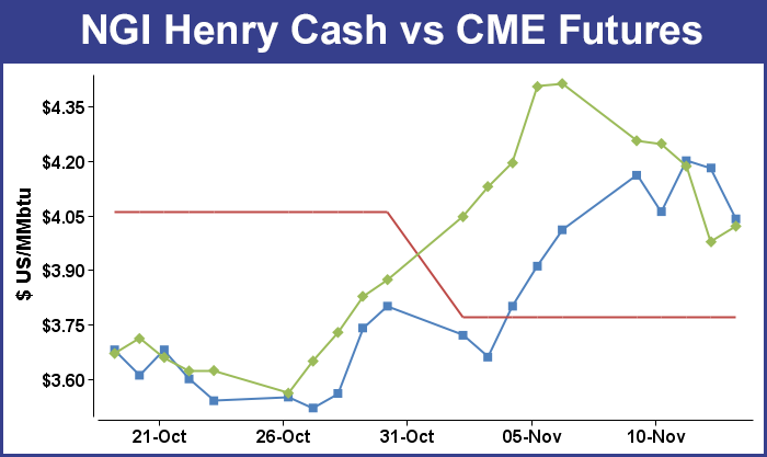
Market points responded smartly to the arrival of Polar Vortex-driven cold for the week ended Nov. 14. The NGI Weekly Spot Gas Average added to the previous week’s 27-cent gain with an additional 55 cents to $4.18. Not one single market point posted a loss, although one location, PG&E Citygates came in unchanged at $4.49. Most points added between 30 to 50 cents, but a few New England locations were up by close to $2.
The week’s greatest gainers were Algonquin Citygates up $1.96 to average $7.00 with Tennessee Zone 6 200 L right behind at $1.88 higher at $6.75. Tennessee Zone 5 200 L was a distant third rising $1.18 to $4.95.
Of the actively traded points at the lower end of the spectrum ahead of PG&E Citygates was NGPL Gulf Coast Mainline with a 28-cent advance to $4.05. Several Producing Region points saw gains of 31 cents, the Henry Hub up to $4.13, Texas Eastern E LA climbed to $4.05 and Tennessee 800 L made it to $4.07.
Futures bulls were not so fortunate. Last week December futures posted an advance of 53.9 cents. This week December futures shed 39.2 cents to $4.020.
The weekly storage report delayed by a day for observance of the Veterans Day Holiday was only a modest surprise as for the week ended Nov. 7, the Energy Information Administration (EIA) reported an increase of 40 Bcf. December futures had fallen to a low of $3.956 after the number was released and by 10:45 EST, December was trading at $3.983, up 0.6 cent from Wednesday’s settlement.
Prior to the release of the data, analysts were looking for an increase of about 38 Bcf. An analysis by United ICAP revealed an increase of 37 Bcf , and Citi Futures Perspective analysts calculated a 46 Bcf increase. Bentek Energy utilizing its flow model anticipated an injection of 38 Bcf.
“We were hearing anywhere from 36 Bcf to 38 Bcf, and the market came off a couple of cents,” said a New York floor trader, who expected the market to trade below $3.95 on Friday.
“The 40 Bcf net injection was slightly above the consensus expectation, but certainly not outside of the range, a modest bearish surprise that won’t prompt any major overhaul to overall forecasts,” said Tim Evans of Citi Futures Perspective. “Attention will quickly return to the debate over whether the current cold snap is enough to support prices from current levels, given that more moderate readings will return by the last week of the month.”
Inventories now stand at 3,611 Bcf and are 220 Bcf less than last year and 237 Bcf below the five-year average. In the East Region, 8 Bcf were injected and the West Region saw inventories increase by 4 Bcf. Stocks in the Producing Region rose by 28 Bcf.
Analysts see a period of price consolidation as temperature forecasts don’t appear quite as aggressive as before. “[Friday’s] 40 Bcf storage injection was proximate to average industry ideas but 6 Bcf larger than our expectations, said Jim Ritterbusch of Ritterbusch and Associates in closing comments to clients. “The report was generally viewed as neutral and as a result, failed to prompt much price response. Supply peak was established at 3.611 Tcf. And although comparatively strong withdrawals will be seen within the next couple of EIA reports, most temperature models are shifting in a less bullish direction.
“Cold forecasts stretching out through the next couple of weeks are becoming smaller in terms of coverage with deviations from normal considerably less than those projected a week ago. As a result, this market could be challenged in maintaining value north of the $4 mark short of an early December cold spell. We look for nearby futures to settle into a phase of consolidation next week following some dramatic price swings in both directions during the past 3 weeks. We have laid out fresh projected price parameters between about $3.84 and $4.25 in looking out over the next couple of weeks. We are also looking for a place to reestablish bull spreads next week should the low side of our expected trading range be tested.
In Friday’s trading gas for weekend and Monday delivery retreated, as steady weather conditions convinced traders that committing to three-day deals at elevated prices was less attractive than spot purchases using convenient electronic communications.
Price declines were most dramatic in New England, where traders shied away from quotes for Friday gas upwards of $10.00. Double-digit declines were widespread, and only isolated points in the Midcontinent and Rockies managed to record gains.
Weekend and Monday gas in the Northeast fell hard in spite of weather forecasts calling for below normal temperatures. AccuWeather.com predicted Boston’s 45 high Friday would fall to 40 on Saturday and hit 45 on Monday. The seasonal norm in Boston is 52. New York City’s Friday peak of 42 was to inch up to 43 Saturday and to 45 Monday. The normal mid-November high in New York is 54. Philadelphia’s Friday high of 42 was expected to climb to 44 Saturday and 47 on Monday. The normal high is 56.
Quotes at the Algonquin Citygates plunged $3.61 to $6.50, and gas at Iroquois Waddington slid 6 cents to $4.55. Deliveries to Tennessee Zone 6 200 L shed $3.59 to $6.16.
Deliveries into the Mid-Atlantic fell by double-digits. Gas on its way to New York City on Transco Zone 6 dropped 40 cents to $3.60, and gas on Tetco M-3 was down 44 cents to $3.56.
Monday peak power prices offered little incentive to purchase incremental volumes. IntercontinentalExchange reported Monday peak power at the ISO New England’s Massachusetts Hub tumbled $12.13 to $64.06/MWh, and deliveries to the PJM West terminal fell $2.22 to $53.28/MWh.
“Waves of cold air will continue to invade the Boston area this weekend and next week and will bring another opportunity for snow,” said AccuWeather.com meteorologist Alex Sosnowski. “Much of this weekend will be dry around Boston in the wake of the snow that fell on part of the region on Thursday night into early Friday morning. The weather will be cold enough to require winter clothing for many people and to allow some ski resorts to make snow in preparation for Thanksgiving.
“Temperatures will periodically drop to the freezing mark around the city at night,” with temperatures in the 30s during daylight hours and highs in the 40s this weekend. “After a cross-country January-like storm affects the Rockies and Central states this weekend, there is a chance that rain mixes with or changes to wet snow before ending in part of the area Monday night.”
Marcellus points also weakened. Weekend and Monday gas on Millennium fell 20 cents to $3.13, and Transco Leidy was seen 21 cents lower at $2.85. Parcels on Tennessee Zone 4 Marcellus fell 11 cents to $2.53, and on Dominion South gas was quoted at $3.24, down 25 cents.
Market points in the Great Lakes and Midwest also posted losses, but not at the rate of eastern locations. Weekend and Monday parcels on Alliance fell a penny to $4.39, and at the ANR Joliet Hub gas was seen at $4.37, down 2 cents. At the Chicago Citygates, gas fell 6 cents to $4.37, and at Demarcation packages came in at $4.39, down a penny. Buyers on Consumers saw their quotes drop a penny to $4.35, and gas on Michcon fell 5 cents to $4.33.
Traders continued to mull the possibility that the present cold onslaught might be something of a singular event, but whether or not the cold air pounding the country was a “one-off” event remained to be seen with calendar winter over a month away. Forecasters at Commodity Weather Group (CWG) saw a normal 11-15 day period with above normal temperatures confined to California and the desert Southwest.
“A powerful cold outbreak continues to dominate next week with good model agreement,” CWG President Matt Rogers said. “We edged Chicago and St. Louis into upper single digit low temperatures by Tuesday morning, an impressive feat for November, while we also shifted the East Coast a bit colder by the middle of next week with highs only in the upper 30s Tue-Wed for Philadelphia.
“Despite demand increases for next week, warmer changes continue to mount by the second half of the six-to-10 day into the 11-15 day. While no major warming is seen at this point, the loss of the gatekeeper and Alaskan high pressure ridging features help mix in milder Pacific air to keep the warmer risks greater than the colder ones for the overall 11-15 day. Our current scenario favors a brief warm-up in the East with a transient weak cooling by days 14-15. The models are still in good agreement on a late month stratospheric warming that favors colder risks for December.”
Futures prices Thursday took a major tumble as forecasters called for some moderation in the current cold onslaught and in some corners the cold was being looked at as a “one-off event” and not characteristic of the winter heating season. Cascading petroleum prices didn’t help the cause of the bulls either, and some analysts had sensed market weakness going into the day’s trading.
Noting Wednesday’s weak performance Drew Wozniak, vice president of Market Research and Development at ICAP Energy LLC said Thursday morning “We are in a congestion band of $4.12 to $4.25 but the market feels heavy. Then next band below this is $3.99 to $4.07. The reason I am saying this is if Natty can get below the $4.12 level, there could be a rapid sell-off. Conversely, the upside is less consistent but there is a band of consolidation from $4.36 to $4.46.
“After the rundown from [Tuesday’s] post-close Bull blip, we entered very choppy waters. Volume is still low with high chop as the algos [algorithmic traders] battle it out and the human force is not participating – it’s the signature. I am Bear for the moment, as any lift has been weak and short lived.”
Noon updates to the weather outlook suggested somewhat less cold. “Overall, the 12z GFS is pretty good,” said meteorologist Joe Bastardi of WeatherBELL Analytics. “It shows, correctly, the change in the source region of the air. This means that the troughs won’t summon super cold air once by the first 8 days. That does not mean it has to be warm, just not as bitingly cold.
“The trough in the 8-10 Day is likely to be stronger than the model has. However, behind it the chill is of the ‘normal’ variety, something you’d expect, not the historic stuff that is going on now.”
Bastardi called the new GFS data “palatable” and said the “6-10 Day period will be chilly, just not historic. Would not change your morning strategy based on this run.”
© 2024 Natural Gas Intelligence. All rights reserved.
ISSN © 2577-9877 | ISSN © 1532-1258 |